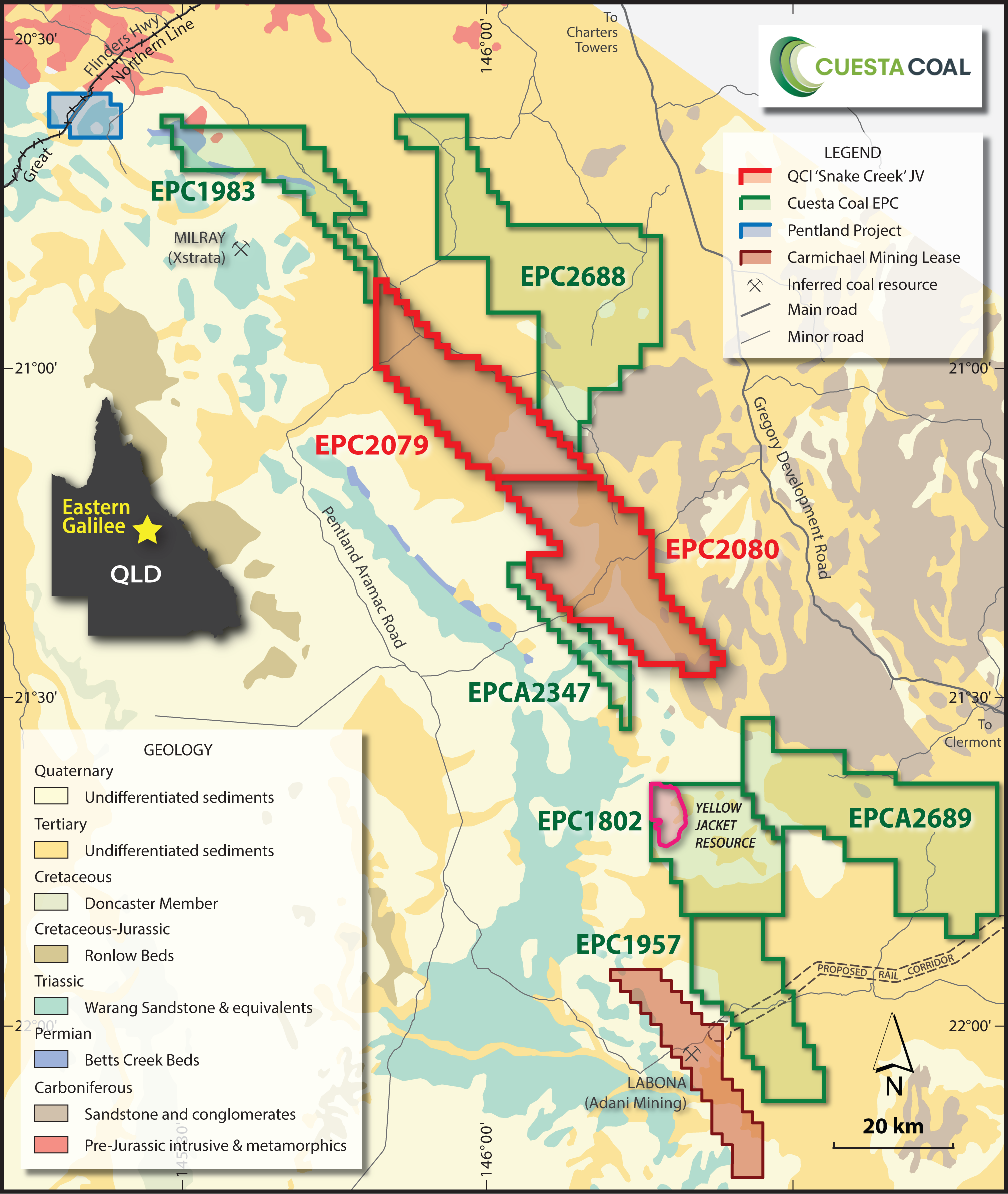
EAST WANDOAN (Thorn Hill)
OVERVIEW
The East Wandoan Project comprises three granted permits. The granted permits are EPC 1955 covering 64 sub-blocks, EPC 2237 comprising 89 sub-blocks and EPC 1987 comprising 115 sub-blocks.
The area occurs in a strip which trends in a South Easterly direction approximately 25km northeast of Wandoan town, which is 400km northwest of Brisbane. The area is gently undulating and largely open with some remnant patches of native vegetation. Shown in the diagram below is a cross section for the Thorn Hill Deposit located in the southern end of EPC 1955.
The Thorn Hill Deposit has a total coal resource of 44.6 Mt identified in its 2012 drilling campaign (22.1 Mt in the Indicated Resource category, and 22.5 Mt in the Inferred Resource category).
PREVIOUS EXPLORATION
Over the period June-October 2011, Cuesta carried out a 17 open hole, 3 Core hole program in the southern corner of EPC 1955 immediately to the north of the Bottle Tree Deposit held by Cockatoo Coal. All holes were geophysically logged and core samples were sent away for analysis. An Inferred JORC resource of 23.9Mt was announced by the company on 6th of February 2011.
In March/April 2012 Cuesta completed 39 holes for a total of 59 holes drilled in the southern section of EPC 1955. The drilling has resulted in the delineation of 44.6Mt (22.1Mt Indicated, 22.5Mt Inferred) of resource calculated in accordance with JORC guidelines, and is now referred to as the Thorn Hill Deposit.
HISTORIC DRILLING
Exploration of the Surat Basin commenced in the late 1960s by major companies including Exoil Limited, Shell, Griffin Coal and MIM/Xstrata Coal. Historic early exploration work identified the following first order coal deposits:
- Wandoan Coal Deposits (>1,000 Mt) currently owned by Xstrata Coal;
- Collingwood Deposit (229 Mt) recently acquired from Anglo American by Cockatoo Coal Limited.
A combination of historic poor coal prices and lack of infrastructure in the region hindered the development of the above coal deposits. Recent increased coal demand and prices reactivated strong interest in the region targeting lesser explored coal areas with immediate success. Inferred and Indicated Mineral Resources defined adjacent to the Cuesta Coal tenements include:
- Bottle Tree Deposit (~36Mt) currently owned by Cockatoo Coal Limited
- The Range Deposit (~290Mt) currently owned by Stanmore Coal Limited.
This affords Cuesta an opportunity on these EPCs to identify significant shallow thermal coal deposits.
AMBERLEY
OVERVIEW
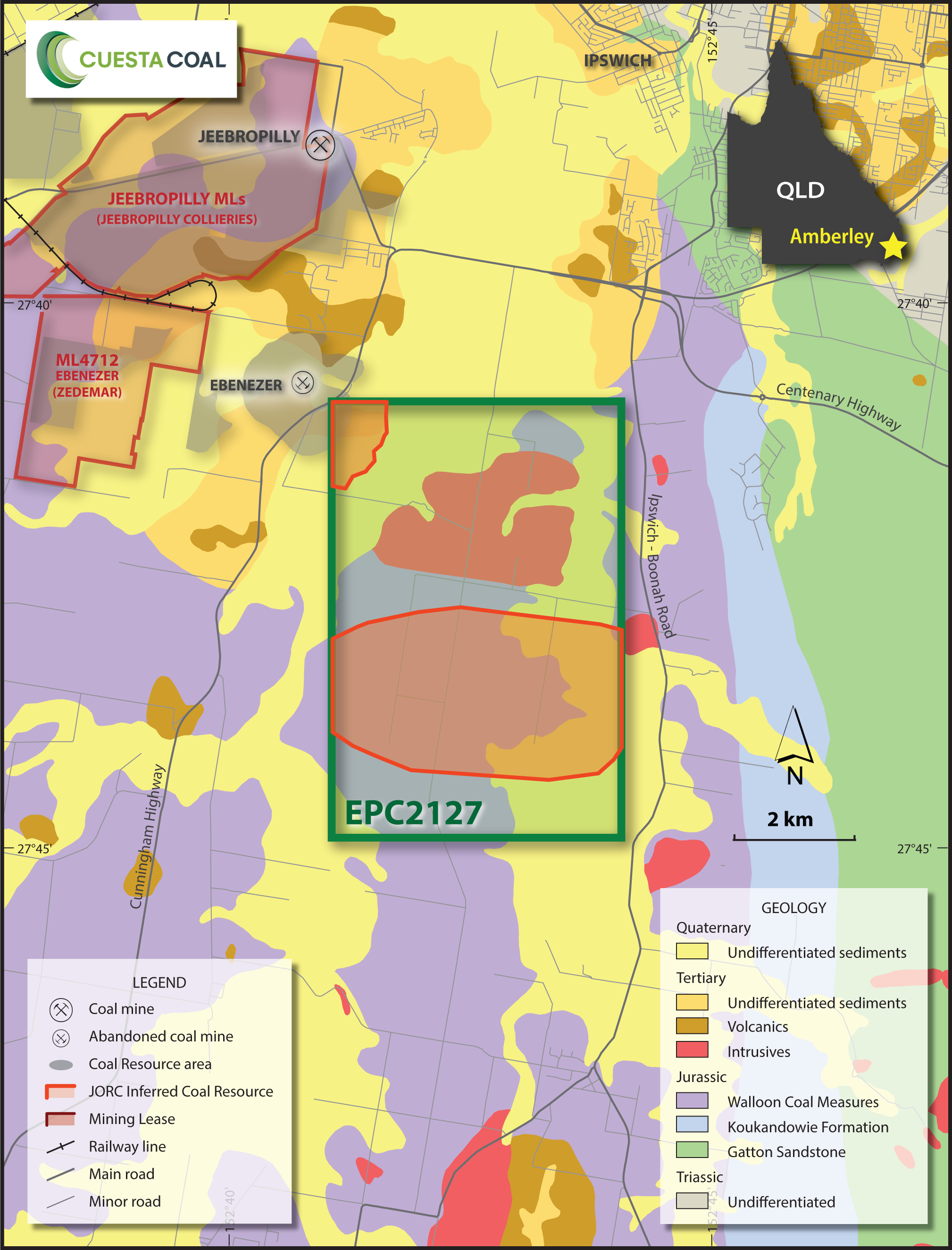
The Amberley Deposit (EPC 2127) comprises 12 sub-blocks covering an area of 36.5km2 and is located approximately 8km south east of the Jeebropilly Coal Mine and 5km from the former producing Ebenezer Mine. The Ebenezer Mine has produced both domestic and export quality thermal coal.
Coal measures in this region are banded Walloon Coal measures. The Amberley Project deposit is situated along strike extensions of existing known coal deposits and is found in eight seam groups – UNA, UNB, A, B, C, D, E & F. Cuesta’s 2012 drilling intersected between 2 to 8 seams with individual seam ply thickness varying from 0.1m to 1.9m, sufficient confidence in seam correlation was achieved.
PREVIOUS EXPLORATION
Historically there have been 17 open holes and 1 cored hole on EPC 2127 drilled by a number of companies exploring the region since the 1970’s. A number of drill holes and water bores on the property indicate coal seams of 2-3m at shallow depths. In 1993, Idemitsu South Queensland Coal drilled hole R1118 within the EPC 2127 area to 126m in depth recording multiple intersections of coal.
INFRASTRUCTURE
The Amberley Project is located 5km from the existing Ebenezer Mining Lease. The Project area is located close to infrastructure, being 8km (by truck) to the Ebenezer coal loading rail loop and 80km (by rail) to the Port of Brisbane.
MONTROSE
OVERVIEW
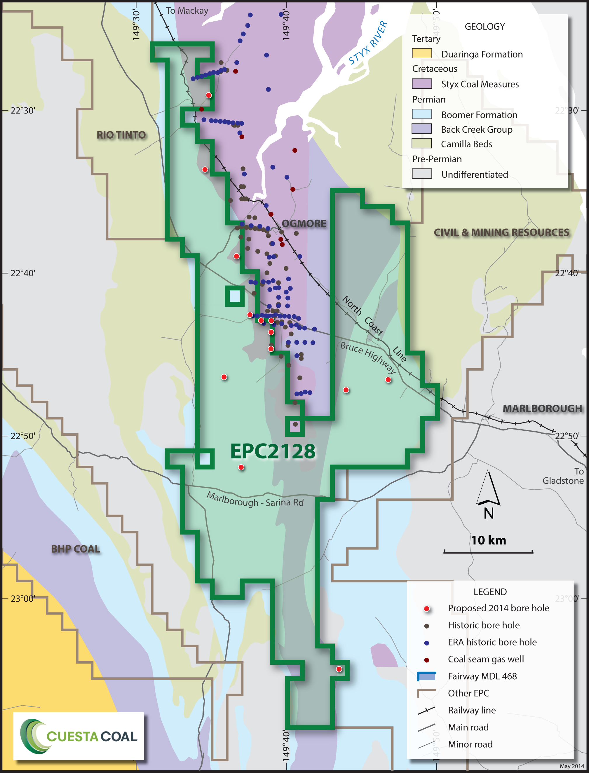
The Montrose project is a significant land holding within the Bowen Basin covering 958km2. It has potential to produce both thermal and coking coal based on information sourced from historical exploration and mining data. The project area has significant infrastructure; The Bruce Highway, a major northern thoroughfare, passes through the area. Running sub-parallel to the highway is the main electrified northern railway line which can transport export coals to the Gladstone port facility some 230km away.
PREVIOUS EXPLORATION
The deposition of Bowen Basin coal measures may exist as part of the Back Creek Group within the project area. Past exploration activity has been limited and focused on the testing of shallow coal potential beside the main North Coast Rail Line. New Hope (Coal) defined a historic resource of 4Mt of coal in the west of the Styx Basin and Waratah Coal has now been granted tenure to validate and further define the resource. Relatively recent exploration has defined two new seam packages towards the base of the Styx Basin which occurs within the project area. EPC 2128 lies in the Connors Arch which is a trough like formation thought to contain Bowen Basin sedimentation. Exploration will target coal seams in the Lower Permian Back Creek Group which are equivalent to the German Creek Coal measures which host high quality coking coal. The Permian depositional history is relatively unknown, but recent geological interpretation has outlined this region as an area where high rank metallurgical coals may be present. The Permian formation is predominantly masked by the younger cover.
EXPLORATION TARGET
The Montrose Project has an Exploration Target of 0–70 Mt.
DEVELOPMENT PROGRAM
Cuesta coal conducted a review of open file available gravity and aeromagnetic information to identify targets for scout drilling. Cuesta have identified target areas in the EPC and have proposed a program to consist of 6–10 open holes to depth of 200m to verify the presence of coal. 1–2 strategically placed cored holes to obtain coal quality data will be drilling in areas of best intersections.
INFRASTRUCTURE
The Montrose Project is located west of the township of Marlborough. It is in close proximity to major infrastructure including the Northern Railway Line and the Bruce Highway. There are a number of major coal companies exploring within close proximity to the project including BHP, Rio Tinto and Waratah Coal. Of particular importance is the planned development of Waratah Coals Styx Project which immediately abuts the Montrose Project to the North.


